
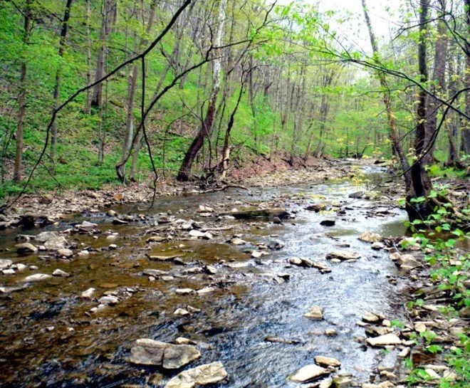
Westmoreland Heritage Trail for Migrating Songbirds
We will meet at the Saltsburg, Pa Trailhead
Leader: Denny McCarthy, dennymccarthy@comcast.net, 412-913-9064.
Directions: Follow Rt 981 north from New Alexandria, about 8 miles, to PA 286 and turn right across the bridge into Saltsburg. After 0.2 miles, turn right on Salt Street and travel 0.4 miles to the playground and trail parking lot.
Description: We will walk this section of the trail out and back toward Sara Steele trailhead, approximately 5 miles round trip. This should be the peak time for spring wildflowers and migration movements for warblers and vireos.

Buffalo Creek Nature Park/Todd Sanctuary for an Audubon-Led Walk
We will meet in the BCNP parking lot.
Leader: Tom Moser, mosertd@gmail.com, 412-478-5513
Directions: Address is 154 Monroe Road, Sarver, PA. From Route 28, take PA-356 North for 0.9 miles. Turn right onto Monroe Road and follow for 0.8 miles. The road will wind around as you make your way down a hill. BCNP will be on your left at the bottom of the hill. Todd Nature reserve is 2 miles further up the hill at 367 Kepple Road, Sarver, PA.
Description: Depending on the number of attendees, we will first car pool 2 miles to the Todd Nature Reserve for an Audubon naturalist-led “Birds and More” walk on trails through ravines, forests and reverting meadows with streams and a pond. We will then return to the Nature Park for a level walk along Little Buffalo Creek via the Butler-Freeport trail. Buffalo Creek Valley is listed as Important Bird Area # 22. Last year in late May we identified 45 species. The Park facilities feature the Babcock Nature Center, an Audubon Nature Store, concessions and modern restrooms. You can bring a bagged lunch for socializing after the walks in the adjacent picnic pavilion.

Pennsylvania Society for Ornithology Birding Festival
The Pennsylvania Society for Ornithology Birding Festival will be held in Washington County in early June this year! We have a full lineup of great speakers, field trips to local destinations and vendors selling bird themed merchandise to interest all levels of birders. Join birders from across the state for this weekend festival! All the details are at the following link.

Evening Vespers at Spruce Flats Bog
We will meet at the Darlington Inn
Leader: Denny McCarthy, dennymccarthy@comcast.net, 412-913-9064
Directions: We will begin at the Darlington Inn just off Route 30. Address is 1473 Darlington Rd, Ligonier, PA 15658. Following Rt. 30 east from Latrobe, bear right onto Darlington Road (2043) just before you cross Longbridge. In about a mile, you will see the restaurant on your right and the parking lot on your left. Please RSVP your dinner reservation to Denny McCarthy, 412-913-9064 or dennymccarthy@comcast.net no later than May 24. After dinner we will drive to the parking lot at Spruce Flats bog. For the bog, from Rt 30, drive two miles east to Ligonier, turn south onto Route 381 and drive 2 miles to Rector. In Rector, turn left onto Linn Run Road and drive 7.7 miles to Laurel Summit State Park. Turn left as you approach the pavilion and drive into the parking lot. Find a trail on the right side of the parking lot that leads to the bog boardwalk.
Description: It’s hard to beat a Hungarian buffet and a leisurely walk to the haunting songs of woodland thrushes and high elevation warblers. It is always a bit colder at the bog and may be muddy, although the actual viewing is from an elevated boardwalk. The bog contains many special flora including balsam fir trees, mountain laurel (our state flower), and carnivorous sundews and pitcher plants. Bring mosquito repellent.

Wolf Rocks Trail for a Scenic Hike
We will meet at the trailhead.
Leader: Denny McCarthy, dennymccarthy@comcast.net, 412-913-9064
Directions: On Rt 30, drive 2 miles east of Ligonier. Turn south onto Rt 381 and drive two miles to Rector. In Rector, turn left onto Linn Run Road and drive 7.7 miles to Laurel Summit State Park. Turn left as you approach the pavilion and drive into the parking lot. Find the trail on the left side of the parking lot that leads to Wolf Rocks.
Description: We will hike this trail to the scenic Wolf Rocks Overlook. It is about a 4.5-mile forested loop over relatively flat but sometimes very rocky ground. Sturdy shoes and a hiking pole are helpful. Many breeding songbirds along with spring and summer wildflowers like Mountain Laurel can be seen. With a little luck we may spot Timber rattlesnakes sunning on the rocks.

Global Big Day Bird Count. Various locations
Leader: Steve Manns, psuloon@yahoo.com, 724-963-6612
Directions: Bird your favorite areas - Be a part of something bigger!
Description: Be a part of birding’s biggest team! Global Big Day is an annual celebration of the birds around you. No matter where you are, join us virtually on May 11, help celebrate World Migratory Bird Day, and share the birds you find with eBird.
Participating is easy—you can even be part of Global Big Day from home. If you can spare 5 or 10 minutes, report your bird observations to eBird online or with the free eBird Mobile app. If you have more time, submit several checklists of birds throughout the day. You never know what you might spot. Your observations help us better understand global bird populations.
Last year, Global Big Day brought birders together virtually from more countries than ever before. More than 51,000 people from 201 countries submitted 132,000 checklists with eBird, setting new world records for a single day of birding. Will you help us surpass last year’s records?
How to participate
· Get an eBird account: eBird is a worldwide bird checklist program used by millions of birders. It’s what allows us to compile everyone’s sightings into a single massive Global Big Day list—while at the same time collecting the data to help scientists better understand birds. Watch birds on May 11: It’s that simple. You don’t need to be a bird expert or go out all day long, even 10 minutes of birding from home counts. Global Big Day runs from midnight to midnight in your local time zone. You can report what you find from anywhere in the world.
· Enter what you see and hear in eBird: You can enter your sightings via the website or download the free eBird Mobile app to make submitting lists even easier. Please enter your checklists before 14 May to be included in our initial results announcement.
· Watch the sightings roll in: During the day, follow along with sightings from more than 200 countries in real-time on our Global Big Day page.

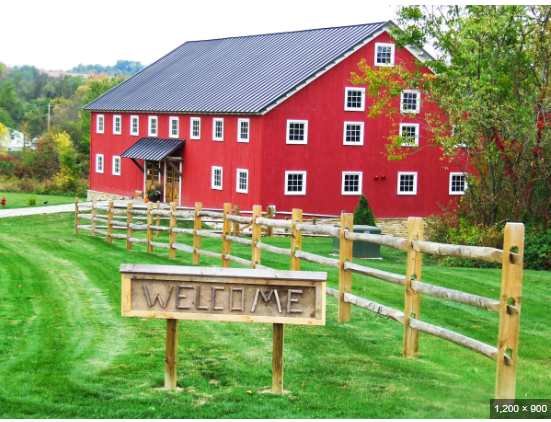
Club Meeting
Meet inside the Donohoe Center at 7:00 p.m. Doors open 6:30 p.m.
Leader: Alex Busato, busatoalex67@comcast.net, 724-963-6612
Directions: Turn north onto Donohoe Road at the Route 30 traffic light near the overpass to the Westmoreland Mall in Greensburg. Drive north on Donohoe 1.7 miles past WOW Outlets until you see the sign on the right for the Donohoe Center. Address is 214 Donohoe Road, Greensburg, PA. 15601. “The Barn” is in the back.
Description: Please join us for our spring members meeting. We will provide updates on club goings-on including the upcoming Bird Atlas. Come, relax and enjoy socializing with other club members, listen to speakers, programs and other topics. Homemade snacks and baked good contributions are always appreciated.
Special Guest Speaker – Don German, Plant Manager, Mon Valley Works, US Steel Corporation: “The Bald Eagles of US Steel “

Bushy Run Battlefield State Historic Park for Spring Migrants and Wildflowers
Meet at the walking trails parking lot at 8:30 a.m.
Leader: Regina Gaison, rgaison1@gmail.com, 724-853-7715
Directions: The park is located off Rt 66 between Greensburg and Rt 22. From either direction, turn off Rt 66 (old 66, not the toll road) onto Rt 993 and drive until you come to the park. The GPS address is 1253 Bushy Run Road, Jeannette, PA 15644. Find and park in the lot near the entrance to the walking trails.
Description: We will hike the Edge Hill Trail, the main trail around the park, for the best chance for viewing wildflowers and migrating passerines. 114 bird species have been sighted. Time permitting, we may also walk Iroquois Trail and Flour Sack Trail. For those interested in brown-bagging a lunch, we can find an available picnic table.

– Kooser State Park for Spring Wildflowers and Early Migrants
Meet at the long trailhead parking lot along Rt 31 at 8:30 a.m.
Leader: Denny McCarthy, dennymccarthy@comcast.net, 412-913-9064
Directions: From the Donegal Turnpike Exit, head east on Rt 31 for 9.2 miles and watch for the Main entrance on your right. You can follow Lake Loop Trail thru the park to the trailhead parking lot on the other end of the park. Or you can drive past the main park entrance and turn right after 0.2 miles to the big long parking lot visible from Rt 31.
Description: We will hike the Kincora, Tree Army, and Kooser Run Trails, which essentially loop around the park. Spring will just be arriving at this elevated park with migrants arriving and wildflowers blooming. Lake and stream areas along with deciduous and coniferous forests can be viewed. Picnic areas are available for those wishing to socialize over a brown-bag lunch.
Cedar Creek - Scenic Hike for Early Flora and Fauna
Meet at the parking lot by the confluence of Cedar Creek with the Youghiogheny River at 10:00 a.m. (Coordinates are 40°10'43.1"N 79°46'42.1"W.)
Leaders: Mark Bowers and Loree Speedy, monarda55@gmail.com, 724-454-4012
Directions: Address is 216 Municipal Drive, Belle Vernon, PA 15012. Whether driving north or south on SR 51 in Rostraver Township, turn onto Concord Lane. If driving north from the intersection of I-70 and SR 51, you will turn right onto Concord Lane at a red light by the Burger King, and then turn right onto Municipal Drive (roads here have been recently modified). If driving south on SR 51, turn left onto Concord Lane at a red light by Harper Drive and turn left onto Municipal Drive. Follow Municipal Drive 0.7 mile and turn left onto Evergreen Drive. This left turn is at the main entrance to Cedar Creek Park. Follow Evergreen Drive 1.4 mile to a parking lot at the end of Evergreen Drive.
Description: We will tour this scenic venue looking to ID early spring trees, plants, animals, and birds. The plan is to walk the flat floodplain trail in the gorge and/or the GAP bike trail. Of course, dress for the season and weather conditions, and be aware that some trail areas may be steep, wet, and slippery.

Yellow Creek State Park – Migrating Waterfowl
Meet at Dragonfly Pond parking lot at 8:30 a.m..
Leader: Denny McCarthy, dennymccarthy@comcast.net, 412-913-9064
Directions: Yellow Creek State Park is along Rt 422 between the towns of Ebensburg and Indiana. The address is 170 Route 259 Highway, Penn Run, PA, 15765. GPS Coordinates are 40°34’41”N, 79°0’2’W.
Description: This is primarily a Waterfowl outing and should be near the peak of the spring migration. Binoculars are a must and spotting scopes are appreciated. It is easy walking to various points around the lake, including an observatory. Yellow Creek State Park covers 3,140 acres containing varied ecological areas and has been designated as Important Bird area #23. Its close proximity to Chestnut Ridge allows for viewing of large numbers of waterfowl and gulls stopping to use the lake. There are 219 total birds verified on the park checklist, with 87 of those seen in March.
St Vincent Wetlands & Winnie Palmer Nature Reserve
Meet at 8:30 a.m. at the Gristmill parking lot off Beatty County Road. After wetlands hike, drive to Winnie Palmer Nature Reserve and park in front of barn.

Overnighter to Middle Creek Wildlife Management Area for Snow Geese
Specific times and other logistics to be determined.
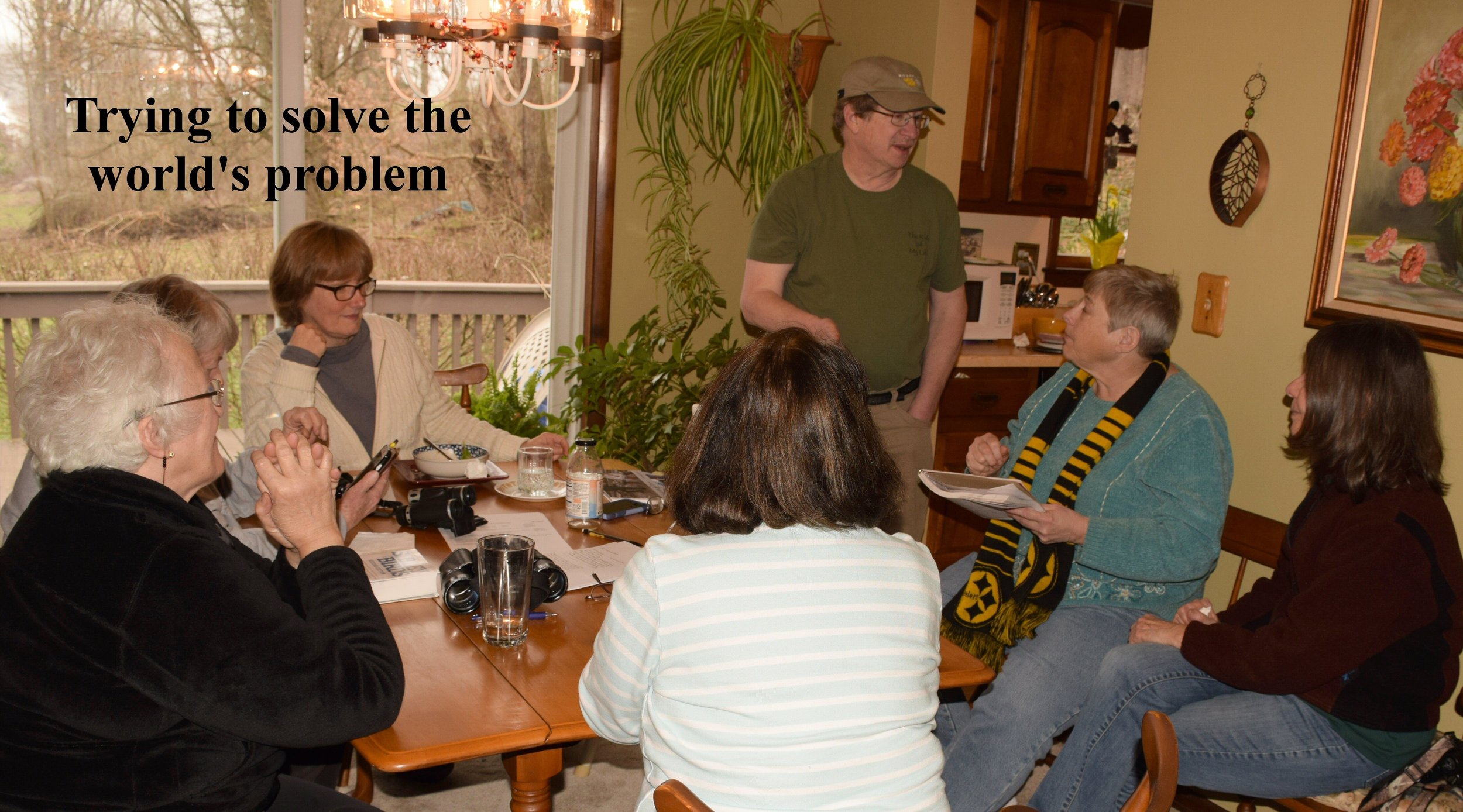
Armchair Bird Outing at the Home of Georgia Shalek / Great Backyard Bird Count
Meet at Georgia’s between 8:00 a.m. – 3:00 p.m.
Leader: Georgia Shalek, 724- 887-9210, gshalek@gmail.com / Steve Manns, 724-309-3312, psuloon@yahoo.com.
Directions: 1481 W. Pittsburgh St., Scottdale, 724- 887-9210. Take the Scottdale Exit off 119 South. Make a left off the exit ramp onto 819 South toward Scottdale. Take a right at the light onto w. Pittsburgh St. and follow it through the 2nd light for 2 miles to the bottom of a large hill where you’ll cross a small cement bridge. Turn left immediately after you cross the bridge between the guard rail and fire hydrant. If you come to Creek Road, you’ve gone 5 feet too far.
Description: Georgia Shalek has once again invited us to her home for a feeder-watch get together. Time: 8:00 - 3:00 with a walk around the grounds and lunch. Throw some boots into your car if you want to do the walk. Bring any drinks or snacks you want to share. Arrive and depart at your convenience. No rain date. Bad weather – still on for those who can make it.
If you can’t make Georgia’s, do your own armchair birding as part of the Great Backyard Bird Count. Count the maximum number of each species at your feeder at any one time from Feb 16-19. Walk the neighborhood to add non-feeder species. Count on as many of the four days as you wish. Turn data in to Steve Manns. psuloon@yahoo.com

Loyalhanna Dam Site – A Gathering of Eagles
Leader: Dale Matuza 724-327-0826, dmmatuza@comcast.net
We will meet at the office parking lot at 8:30 a.m
Directions: The site is located a few miles east of Saltsburg, PA off routes 286 and 981. The address is 440 Loyalhanna Dam Road, Saltsburg, PA, 15681-9302. GPS Coordinates are 40 degrees, 26' 49.16" N, 79 degrees, 26' 40.34" W.
Description: We will hopefully be viewing several Bald Eagles and other waterfowl from the crest of the dam. In addition, we may walk the short trail from the parking lot down to the lake. There are modern restroom facilities. Dress for the season and weather conditions.
Pittsburgh Aviary/Montour-Panhandle Trails
Date & Time:, times to be determined. RSVP to Alex by January 6th

Bushy Run Christmas Bird Count
Leader: Steve Manns, psuloon@yahoo.com,
724-963-6612
Description: This year’s count will take place on December 30, 2023. Please contact Steve at psuloon@yahoo.com to grab a spot or team up with another party. Want to bird yourself? Great!!! If you are in the CBC circle you can tally the birds you see that day.
Check to see if you are in the circle on this map: https://www.arcgis.com/apps/View/index.html?appi d=ac275eeb01434cedb1c5dcd0fd3fc7b4 Zoom in to see if your yard is in the circle for the count. Doesn’t matter if you are a night owl or an early bird. You can count the birds in the circle between 12AM and 12AM. Turn data in to Steve.

Overnight Outing
Leader: Alex Busato, busatoalex67@comcast.net, 724-963-6612
We are again contemplating an overnight outing. Details will be provided at a future date.

Club Meeting – Member’s Night
Meet inside at the Donohoe Center at 7:00 p.m. Doors open 6:30 p.m.
Leader: Alex Busato/Tom Moser, busatoalex67@comcast.net, 724-963-6612
Directions: Turn north onto Donohoe Road at the Route 30 traffic light near the overpass to the Westmoreland Mall in Greensburg. Drive north on Donohoe 1.7 miles past WOW Outlets until you see the sign on the right for the Donohoe Center. “The Barn” is in the back.
Description: After a short administrative meeting, those of you who want to share your seasonal experiences for the past year, let Tom Moser (mosertd@gmail.com, (412-478-5513) know prior to the meeting. Bring your nature pictures on a flash/USB drive. Limit your show to 10 minutes. These “show and tell” pictures can be from actual outings, trips, vacations, other adventures or just shots from around your backyard or neighborhood.
Nature Paraphernalia Auction Fundraiser: Have any nature paraphernalia to donate to the club – books, feeders, checklists, old binoculars, hand lens, working electronics, baked goods, a husband or wife or significant other, etc.? Items donated to the club will be sold at silent auction for $1.00 a ticket or 5 for $3.00.
Finally, we will appreciate members who can provide baked goods such as cookies and pies to share. Please bring your own drinks since coffee and tea are no longer provided.
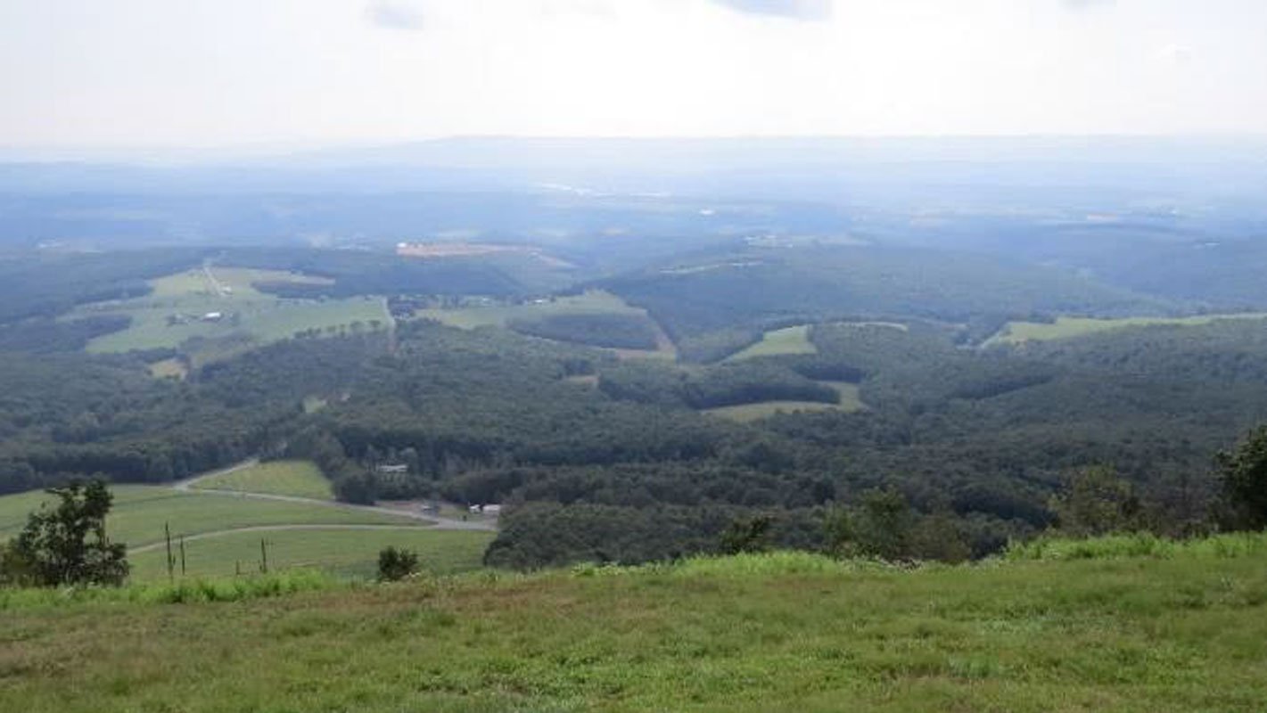
Allegheny Hawk Watch
Meet at the lookout at 10 a.m. 40.08184599799254, -78.72774567522777
Leader: Tom Moser, mosertd@gmail.com, 412-478-5513
Directions: From U.S-30 at Reels Corners, take PA-160 north for 4 miles into Central City. Make a sharp right at a BP gas station. When PA-160 makes a sharp left, instead go straight onto Lambert Street (SR1018). Go slowly and watch for the “rough” RR crossing. After the crossing, bear to the right and stay on Lambert Street. Lambert Street becomes Shaffer Mountain Road (SR1018). Proceed 1.4 miles out of Central City and bear right at a Y-intersection onto Lambert Mountain Road. Go 2.9 miles through State Game lands 228 to a small four-way intersection with Fleegle Road. Go straight thru the intersection. This will become a gravel road. Go 0.5 miles to a blue gate on the right. Turn through the gate and go 0.25 miles to the Hawk Watch parking lot. If the gate is closed, there is no admittance since it is not manned and is private property. We will try to make early contact to ensure its availability.
Description: This 5-acre site, managed by the Audubon society, is on the eastern edge of the Allegheny plateau at an elevation of 2850 feet. https://www.alleghenyplateauaudubon.org/allegheny-front-hawk-watch. The site provides a unique vantage point, sitting approximately 800 feet above a valley with a surreal 180-degree view. When weather conditions are right, many raptors follow the valley during spring and fall migrations. Early November is Golden Eagle “season”, with large numbers expected daily, often flying at eye level. If there is bad weather, e.g., fog or rain, an email will be sent to inform the club. Winds from the east are preferred, as they push the birds closer to the lookout for more spectacular viewing. This is mostly a “sit” outing, so dress for conditions and bring a chair and lunch. There is a portable restroom available.

Bridgeport Dam County Park (Jacobs Creek Wetlands) / Jacobs Creek Park (Greenlick Run Lake)
Meet at 8:30 am at the Jacobs Creek Park (Greenlick) parking lot near the boat launch. Waterfowl often take off with the morning sun, so we’ll begin here where waterfowl most often gather.
Leaders: Georgia Shalek, gshalek@gmail.com, 724-887-9210 or 724-875-9222, Mike Smith, skeetor72@yahoo.com, 412-526-8360
Directions: From points east & west - Take Route 31 east through Mt. Pleasant toward the village of Bridgeport. Turn right onto Bridgeport Street and proceed 1.3 miles to a four-way stop sign. Go straight through the stop sign and over the bridge, veering left along the stream. Follow this to the intersection (no stop sign) and turn left. Jacobs Creek Park (Greenlick) will be on your right. Follow to the entrance and park in the lot toward the boat launch. From points North and South -- follow Route 119 to Route 31 East. Follow the directions above to Jacob’s Creek Park (Greenlick).
Description: Bridgeport Dam is a multi-purpose flood control dam on Jacobs Creek, where Jacobs Creek and Brush Run converge. We’ll spend our day beginning at Jacobs Creek Park (Greenlick), then caravan to Bridgeport Dam and on to the Jacobs Creek Wetlands. These beautiful areas often boast large numbers of migrating waterfowl, especially in rainy weather which brings them down to ride out the storms, usually overnight. All these sites are in close proximity with adequate parking. Some of our hiking may take place in grassy, wet, or muddy areas, so toss some boots and rain gear in your car. A scope will also come in handy if you have one.

eBird’s October Big Day Bird Count
Leader: Steve Manns, psuloon@yahoo.com, 724-963-6612
Directions: Various locations as coordinated by Steve (Mostly your choice)
Description: Like Global Big Day, October Big Day is an opportunity to unite around our shared love of birds. This is an all day event and you can submit multiple list for each location. Last October, nearly 35,000 people from 185 countries submitted 80,000 checklists with eBird, demonstrating the power of birds to bring people together, and helping us better understand bird populations. Last year, WBNC was one of the top contributing counties in Pennsylvania.
Turn data in to Steve via sharing eBird List or emailing your list directly to Steve Manns psuloon@yahoo.com.

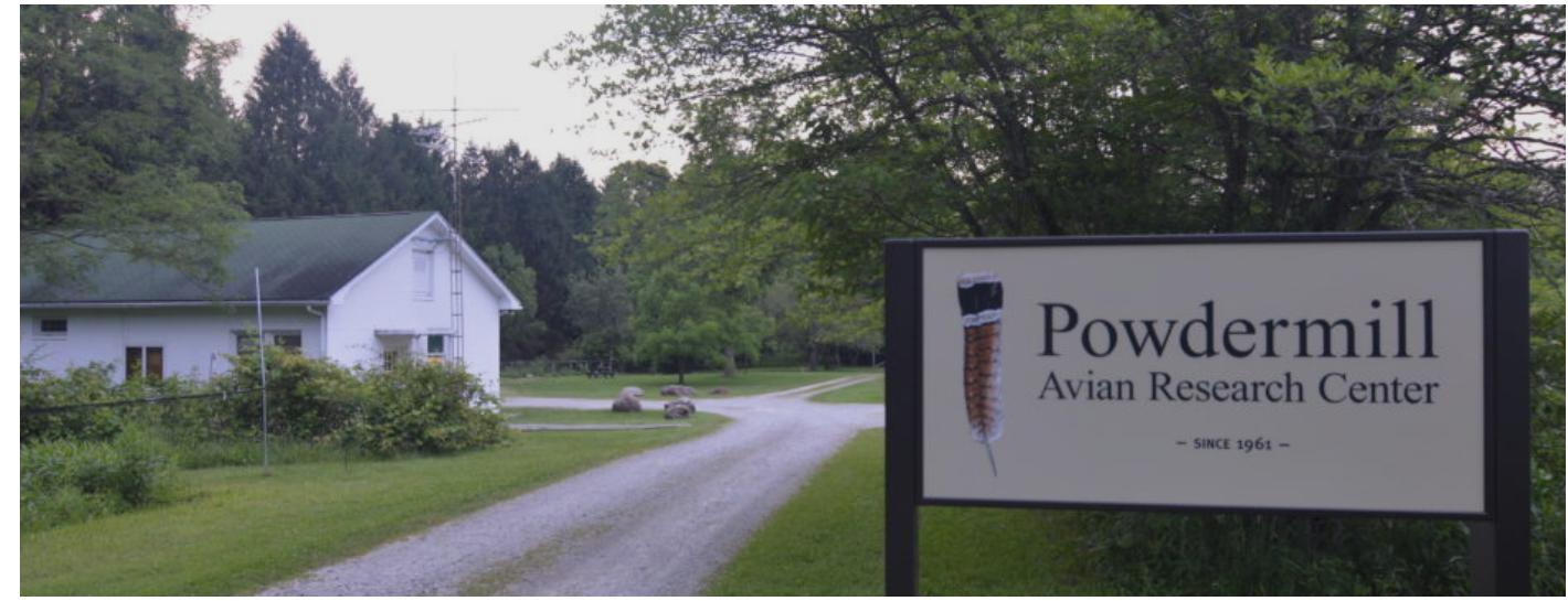
Powdermill Nature Reserve – Nature Event
Meet at Powdermill Avian Research Center Building 7:45AM. Tour starts at 8:00AM
Leader: Denny McCarthy dennymccarthy@comcast.net, 412-913-9064 / Annie Lindsay
Directions: Address is 1795 Route 381, Rector, PA 15677. From Ligonier, PA take Rt 711 south 3.3 miles to the Rector/Darlington intersection. Turn left toward Rector and go 1 mile. At the bottom of the hill, before going over the bridge, turn right on to Rt 381 South. Follow Rt 381 south for 3 miles to Powdermill Avian Research Center (near the intersection of Route 381 and Weavermill Road)
Description: Powdermill Avian Research Center (PARC) will have an Open House event on September 23, and has invited WBNC to tour the bird banding lab and new research facility. Attendees should arrive at 8:00am. PARC's Open House events are behind-the-scenes experiences that allow people to visit the bird banding lab and see up-close how researchers safely capture and band birds, and learn about the data they gather. Visitors will also visit PARC's flight tunnel and hear about how PARC's ornithologists are studying avian perception of glass to provide glass manufacturers and building designers with important information that will help reduce bird-window collisions. During the Open House, WBNC members will have the opportunity to chat with the scientists on staff, and perhaps visiting researchers, about the other projects being conducted at PARC. This part of the outing is expected to last 60-90 minutes but is weather dependent and will be canceled due to heat (>78 degrees), strong winds, or inclement weather. After the Open House, there are options to hike some of the site trails (Sugar Camp, Porcupine Ridge, and Black Birch). The other option is tour the nature center and visit the gift shop, and visit each of the four distinct outdoor gardens, finding specific herbs, wildflowers, barrens plants, and pollinators. Finally, it would be nice to get together around Noon at the nature Center in the picnic area for a brown-bag lunch to review the day’s activities. Since we would like to pre-register, please RSVP to Denny McCarthy by September 11, 2023.

Harrison Hills County Park
Meet at the Environmental Learning Center at 8:30 AM
Leader: Denny McCarthy, dennymccarthy@comcast.net, 412-913-9064
Directions: From points south, take Route 28 North to Exit 16. Turn right at the exit and go approximately a half-mile to Freeport Road. Turn right onto Freeport Road at the traffic signal. The park entrance will be approximately a half-mile on your left. From other points using GPS, the address is 5200 Freeport Road, Natrona Heights, PA. 15065. Follow signs to the Environmental Learning Center.
Description: It’s been a while since we visited this 524 acre venue of deciduous woodlands, grassy meadows, ponds, streams with waterfalls, and a cliff-top trail with a spectacular vista of the Allegheny River valley 400 feet below. We will be looking for early fall migrants and other species that breed in the park. To maximize our enjoyment, we are looking to combine our outing with other events that may be schedule such as outings led by park rangers, other bird clubs and the Friends of Harrison Hills organization. Stay tuned for additional information.
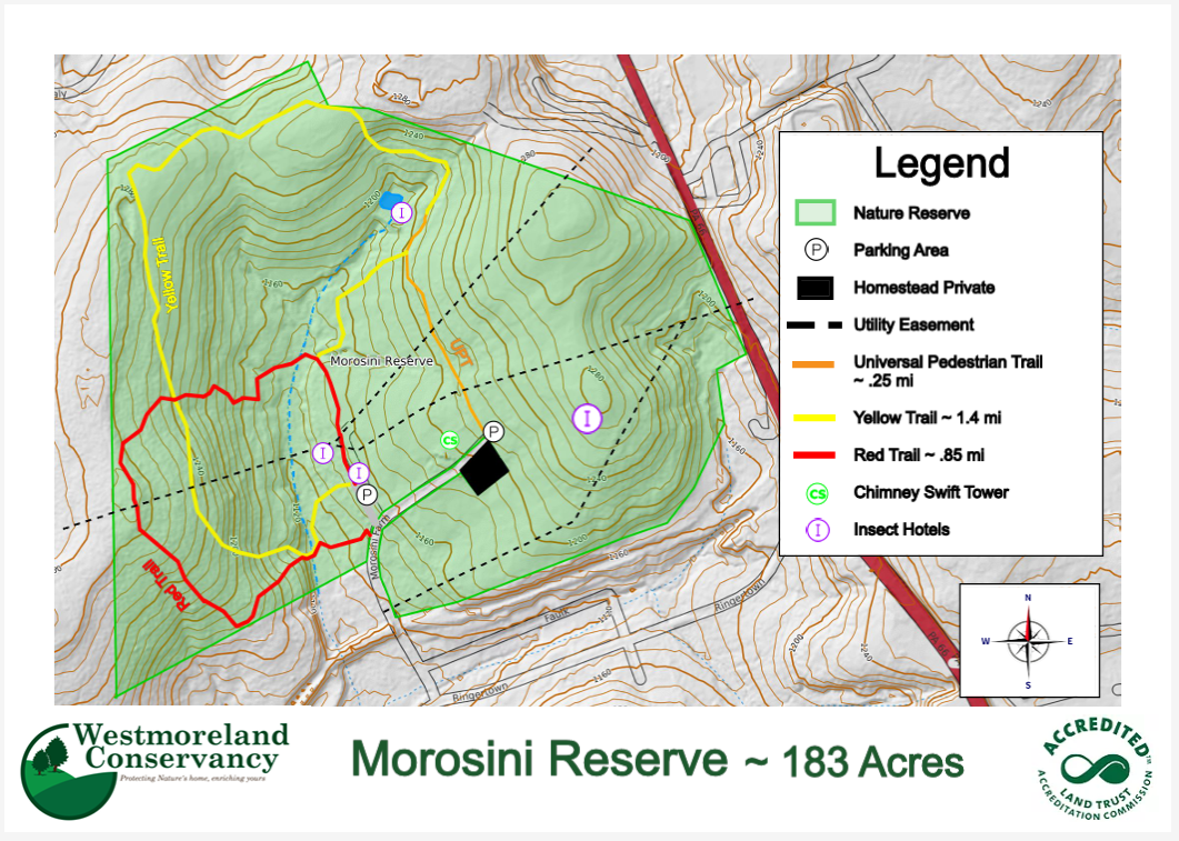
Morosini Reserve - Export PA
Meet at the upper parking lot at 8:30 AM
Leader: Denny McCarthy, dennymccarthy@comcast.net, 412-913-9064
Directions: From Rt. 22, follow Rt. 66 North to the 2nd stop light in Delmont and turn left onto Old Route 22. Follow Old Route 22 and take the 2nd right onto Ringertown Road. Follow Ringertown Road about a mile and turn left onto Morosini Farm Road. Once you drive under the RR overpass, the Morosini Reserve begins on your right. Continue straight ahead past the curve to a paved upper parking lot. N 40° 25.493 W 079° 34.939
Description: This 188 acre property of the Westmoreland Conservancy was a favorite of past club president Dick Byers, who along with other members helped to layout and plan the development of the original property as a reserve. It is a diversified habitat and this will be a general nature hike on its trails covering woodlands and open fields. Be aware some parts can be wet and others quite hilly. There are owl and bluebird boxes and a well-constructed viewing blind.
Club Picnic - Mammoth Park
Meet at picnic Pavilion 12 Begins at 2:00 pm; Dinner at 3:30 pm
Leader: Denny McCarthy, dennymccarthy@comcast.net, 412-913-9064
Directions: From Rt. 30 take the Greensburg/Mt Pleasant exit toward Mt. Pleasant. Continue past the University of Pittsburgh and Westmoreland County Fairgrounds. Turn left in United. At the stop sign one mile past the mammoth Park sign, turn right onto Rt. 981 South. Turn left at the next Mammoth Park sign. Go two miles to the next stop sign; turn left and continue on into the park. Follow signs to Pavilion 12. Park address is 254 County Park Road, Mt. Pleasant, PA. 15666
Description: Please mark your calendars for our social event of the year, 2pm-dusk. We plan to eat at 3:30 pm with a few nature activities squeezed in before or after dinner. Pavilion #12 has shade, electrical outlets, water, plenty of close parking, and is next to restrooms and the lake. The club is hosting this picnic and will provide pulled pork sandwiches. Please bring your own drinks, a side dish or dessert to share, and maybe a comfy chair (those pavilion benches can get hard). Alcohol in non-glass containers is permitted. For you early and late birds, we have the pavilion from 9am-9pm. Please RSVP to Denny McCarthy by Monday, July 24 so we can get the right amount of pulled pork.
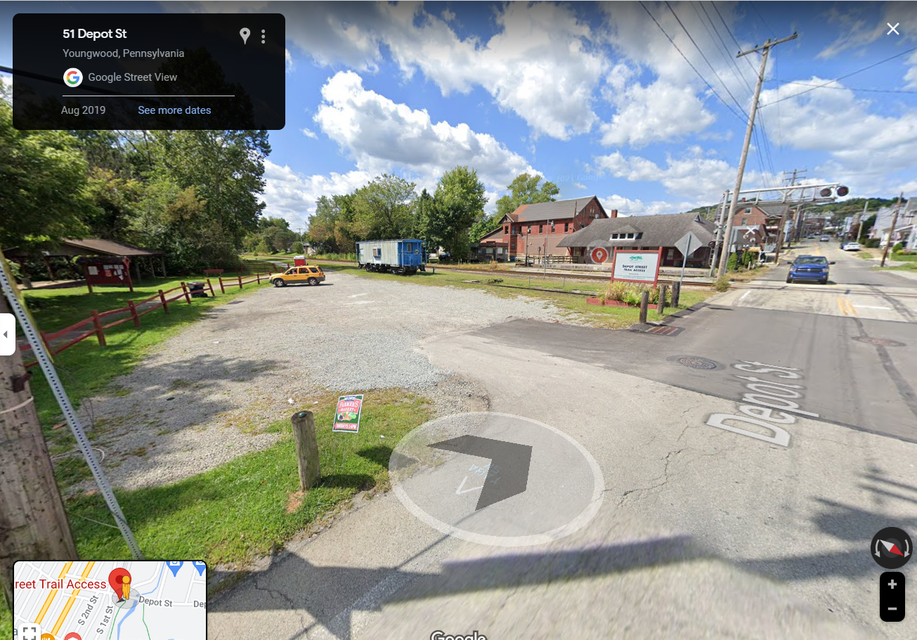
Youngwood Swamp/Sewickley Creek Wetlands
Leader: Regina Gaison, rgaison1@gmail.com, 724-853-7715
Directions:
Youngwood Swamp: From Greensburg, take Route 119 to Youngwood and turn left on Depot Street as if heading to Westmoreland County Community College. Follow Depot Street just a short distance through a traffic light and across the railroad tracks and look for the trail head parking lot on the right.
Swickley Creek Wetlands: From the 5 Star trailhead parking lot in Youngwood to Sewickley Creek Wetlands, turn left out of the parking lot onto Depot Road. Proceed approximately 1.0 miles – you will proceed through 2 traffic lights and one stop sign along the way. Then turn left onto Race Track Road/Silvis Farm Road. In about 0.6 miles (you will pass through one Stop Sign), turn right into the parking lot for the wetlands.
Description: As a summer event, these 2 locations will provide a general nature exploration of local birds, animals, butterflies, dragonflies, trees and wildflowers. We will start at the Youngwood site with a leisurely stroll out and back along the stream and through the swamp area ending up at the WCCC campus. Returning to the trailhead, we will then drive to the Sewickley Creek Wetlands for views from the observation deck and another stroll on mowed grass paths down to the pond area. Afterward, I’m sure we can find an area for a brown-bag lunch and socializing. Both sets of hiking trails are in good condition. The trail head at Youngwood has a portable toilet. Bug spray might be in order.

Murrysville Community Park Wetlands
Leader: Sue Miller
Game Commission-Bears; Sue Miller-Purple Martins; Walk the Wetlands Path

Northmoreland County Park
Meet at 8:30 a.m. in the parking lot of the lower lake
Leaders: Billie and Tom Moser, dewey4301@yahoo.com, 724-325-1946
Directions: Address is 280 Markle Road, Apollo, PA 15613. At Rt 22 in Delmont proceed north on Rt 66 approximately 10 miles. At the “Y” intersection keep left onto Rt 356. In 1.8 miles make a sharp left onto Pine Run Road. In 0.6 miles at a stop sign, turn right onto Markle Rd. In 1.1 miles, turn into the lake parking lot on the left.
Description: This largest of our county parks is 548 acres with a 17-acre lake. We will walk around the 1.1-mile lake trail to catch any summer waterfowl, view the Bluebird/Tree swallow houses and other birds along the lake. Next, we will drive to the upper pond to catch any waterfowl. Finally, we will drive along the park road loop and walk the cul-de-sac to spot any woodland birds in that area. We will find a nice pavilion for a brown-bag lunch.

Pleasant Valley Park
Meet at 8:30 a.m. at the trailhead parking lot in Murrysville, PA.
Leader: Alex Busato, busatoalex67@comcast.net, 724-963-6612
Directions: Address is 2557 Pleasant Valley Rd, Murrysville, PA 15632. From the McDonald’s light in Murrysville, turn south onto Trafford Rd. Cross over the bridge and railroad tracks, then bear left onto Pleasant Valley Road. Continue on this road for 1.2 miles and turn left into the parking lot.
Description: We will hike through the variety of habitats at Pleasant Valley Park. With its open meadows, woods, streams, ponds, and shrubby edge habitat, the park regularly hosts a multitude of Warbler species as well as flycatchers, sparrows, woodpeckers, Scarlet Tanager, orioles, Rose-breasted Grosbeak, and hawks. We will let the warblers be our guides through the upper portions of the park, loosely following Hank’s Trail to the East and looping via the Chestnut, Red Oak, and Hemlock Trails back to the Main Farm Road. This location has produced some uncommon species in the past and potential encounters with Connecticut Warbler, Mourning Warbler, Wilson’s warbler, Cerulean Warbler, Golden-winged Warbler, White-eyed Vireo, Yellow-bellied Flycatcher, and Olive-sided Flycatcher are a good possibility. This hike can be moderately hilly and trail conditions can be muddy in some locations. Sturdy hiking boots, hiking poles, and a good pair of binoculars are recommended.

Evening Vespers at Spruce Flats Bog
Meet at 4:30 p.m. at the Darlington Inn .
Leader: Denny McCarthy, dennymccarthy@comcast.net, 412-913-9064
Directions: We will begin at the Darlington Inn just off Route 30. Address is 1473 Darlington Rd, Ligonier, PA 15658. Following Rt. 30 east from Latrobe, bear right onto Darlington Road (2043) just before you cross Longbridge. In about a mile you'll see the restaurant on your right and the parking lot on your left. Please RSVP your dinner reservation to Denny McCarthy, 412-913-9064 or dennymccarthy@comcast.net no later than May 20. After dinner we will drive to the parking lot at Spruce Flats bog. For the bog, from Rt 30, drive two miles east of Ligonier, turn south onto Route 381 and drive 2 miles to Rector. In Rector, turn left onto Linn Run Road and drive 7.7 miles to Laurel Summit State Park. Turn left as you approach the pavilion and drive into the parking lot. Find a trail on the right side of the parking lot that leads to the bog boardwalk.
Description: It’s hard to beat a Hungarian buffet and a leisurely walk to the haunting songs of woodland thrushes and high elevation warblers. It is always a bit colder at the bog and may be muddy, although the actual viewing is from an elevated boardwalk. The bog contains many special flora including balsam fir trees, mountain laurel (our state flower), and carnivorous sundews and pitcher plants. Bring mosquito repellent.
Buffalo Creek Nature Park/Todd Sanctuary
Meet at 8:30 a.m. in the BCNP parking lot.
Leader: Denny McCarthy, dennymccarthy@comcast.net, 412-913-9064
Directions: Address is 154 Monroe Road, Sarver, PA. From Route 28, take PA-356 North for 0.9 miles. Turn right onto Monroe Road and follow for 0.8 miles. The road will wind around as you make your way down a hill. BCNP will be on your left at the bottom of the hill. Todd Nature reserve is 2 miles further up the hill at 367 Kepple Road, Sarver, PA.
Description: Depending on # of attendees, we will first carpool 2 miles to the Todd Nature Reserve for an Audubon naturalist-led “Birds and More” walk on trails through ravines, forests and reverting meadows with streams and a pond. We will then return to the Nature Park for a level walk along Little Buffalo Creek via the Butler-Freeport trail. Buffalo Creek Valley is listed as Important Bird Area # 22. Last year in late June we identified 35 species. The Park facilities feature the Babcock Nature Center, an Audubon Nature Store, concessions, and modern restrooms. You can bring a bagged lunch for socializing after the walks in the adjacent picnic pavilion.

Stillwater Farms
Meet at 8:30 at 208 Thompson Road, Acme PA 15610
Leaders:
Barb McMillan, whatzupmac@gmail.com, 724-309-5953
Denny McCarthy, dennymccarthy@comcast.net, 412-913-9064.
Directions: Address: 208 Thompson Road, Acme PA 15610
1. Take PA Turnpike to Donegal Exit#91; turn right onto Rt. 31 West. Go ½ mile
2. Pass the little storage unit place, then turn LEFT onto Thompson Road at Glitter Mountain Fireworks. (IF you miss the turnoff and come to a blue metal pole building in the dip you have gone too far. Turn around and come back.)
3. Go ½ mile down Thompson Road. Pass the 3rd house on right - small stone house with brown barn. On the left, past our hayfields you will see our green-roof steel equipment building and on the far hill our hewn log cabin home.
4. Continue about 100 yards. Entrance to Farm is on LEFT across from another farm lane. Turn left through main gate at the gravel pull-in area.
5. Go straight up lane to hewn log house unless instructed to meet us on the agricultural side of the farm.
Description: Barb has an entertaining and informative morning planned for us:
· 8:30 am – hike around a managed 65-acre forest with small woodland bogs, Champion Creek and several unnamed tributaries, Spring ephemerals and maybe morel mushrooms; songbirds, woodpeckers, raptors, and many species we have not identified; natural tufa rock area. These are easy, wide maintained trails, but may be muddy; some up and down moderate hills.
· 10:15 am – presentation YOU CAN GROW ANYTHING ANYWHERE!
· Does a steep slope, a tiny yard, too much shade, a poorly drained site or rocky, clay soil keep you from the joy of gardening? Come learn simple, inexpensive ways to grow nearly any plant anywhere. Learn how to make easy planting pockets with better soil, vertical trellises, raised beds, dry wells, drainage set-ups and more. Come see what we have done at our Farm with large areas that used to be constant sources of erosion and invasives.
· 11:15 am – tour of vegetable and pollinator gardens and berry patches
· 11:30 am – BYO brown bag lunch and socializing on the patio
There is plenty of parking and facilities are available. Please come for the hike or the presentation/tour/lunch or both.

Global Big Day
Leader: Steve Manns <psuloon@yahoo.com>
From Steve: This is by far my favorite birding event of the year. For all of you here I will be seeing where you will be birding on big day and if it is in the county then I will have you make a trip report of your day. All reports to be provided in ebird.org
More details to come.